HORSEBACK RIDING

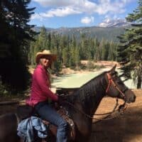
Miles and miles of pristine horseback riding trails are easily accessible from the St. Bernard Lodge. We offer affordable horse boarding rates in our stables, making us the perfect place for you and your horse to stay during your time in Chester. The Lodge is located about a mile away from the famous Pacific Crest Trail and is surrounded by many excellent logging roads that are open to horseback riding. We are very informed about the trails and routes located all throughout the region and are more than happy to provide directions to various trailheads nearby. Visit our Stables page for additional boarding information.

Nearby Trail Ideas

  • The Pacific Crest Trail (PCT): The world-famous PCT can be easily accessed from the Lodge using logging roads. It can be ridden in either direction.
  • Domingo Springs to Drakesbad: A guest favorite, you can arrange to have lunch at Drakesbad and soak in their mineral hot spring pool after your ride.
  • Stover Springs: Located 7 miles north, Stover Springs is a popular endurance-ride staging area.
  • Carter Mountain: Heading south, you can cross the Soldier Meadow and climb beautiful Carter Mountain for a fun challenge with awe-inspiring views.
  • Spencer Meadows Trail: This lovely trail is about 11 miles west of the lodge on Hwy 39.
  • Bizz Johnson Trail: This excellent trail is actually a segment of an old railway route located 25 miles between Westwood and Susanville. It has eleven bridges and two tunnels, all passable on horseback. Six different trailheads are located along the route. This is a great option for exploring the changing colors during the fall months.
  • Caribou Wilderness: Access the Caribou Wilderness through the Hay Meadows trailhead. The South Caribou Lakes Loop is 10 miles long and encompasses seven gorgeous lakes, including Beauty Lake, Posey Lake, Long Lake, and four hidden lakes.

Horseback Riding Trails in Lassen Park

Lassen Volcanic Park boasts over 150 miles of trails, 100 miles open to horseback riding. We love the Juniper Lake area, where you’ll find two horse corrals near the Juniper Lake Campground. Be advised that the trail involves 7 miles on washboard dirt roads to the trailhead. Other riding trails in Lassen Volcanic Park include:

  • Jonesville to Colby Mountain
  • Paynes Creek Recreation Area
  • Sacramento River Bend Area
  • Indian Valley Reservoir
  • Great Shasta Rail Trail
  • Bucks Lake Wilderness area with tie-in to PCT
  • Snake Lake and Deanes Valley
  • Meadow View Equestrian Campground
  • Little Grass Valley Recreation Area

If you would like more information on any of these trails, please call us at 530-258-3382; we would be glad to help you. The best times to plan a horseback vacation in the area are mid-June to late September. Riding is still great in October, but nights start getting cold for the horses. We encourage you to get out and explore the region’s wonders on horseback. However, please keep in mind that:

  • Horses are not permitted to travel cross-country while in Lassen Park
  • It is prohibited to ride or stake animals in picnic areas or campgrounds
  • Stock parties camping overnight are restricted to one of the designated sites at either Summit Lake, Corral, and Butte Lake Hitching Posts, or the Juniper Lake Corral

View this Flyer on saddle and pack use in Lassen Park for more helpful information.

Guided Trail Rides in Lassen Park and Lake Almanor

If you are new to riding or would like to go with an experienced guide, you can take a guided trail ride through both Lassen Volcanic Park and Lake Almanor. During the summer months, both Drakesbad and Plumas Pines stables offer excellent guided trail rides.

In Lassen Park, Drakesbad offers rides ranging from 45 minutes to eight hours. Their rides start from Drakesbad and take you to various points through the park:

  • Boiling Springs Lake – ¾ hour
  • Devils Kitchen – 1¾ hours
  • Terminal Geyers – 2 ¾ hours
  • Corral Meadow – 3 ½ hours
  • Sifford Lakes – 4 hours
  • Horseshoe Lake – 7 hours
  • 5 Lakes Loop – 8 hours

Call Drakesbad directly at 866-999-0914 to make reservations. We suggest planning a day in the southeast corner of Lassen Park. Depending on the time and length of your ride, you may want to have lunch or dinner and enjoy the hot spring mineral pool. If you are not riding, take a hike to one of the locations. Remember that the last three miles into Drakesbad are on a dirt road.

At Lake Almanor, Plumas Pines Stables is located near Plumas Pines Resort, close to the shore of Lake Almanor. The stables are open from Memorial Day to Labor Day. Plumas Pines Stables offers rides ranging from one hour to one and a half hours. Overnight trips can also be arranged. Call 530-259-5170 to make reservations.


BIKING

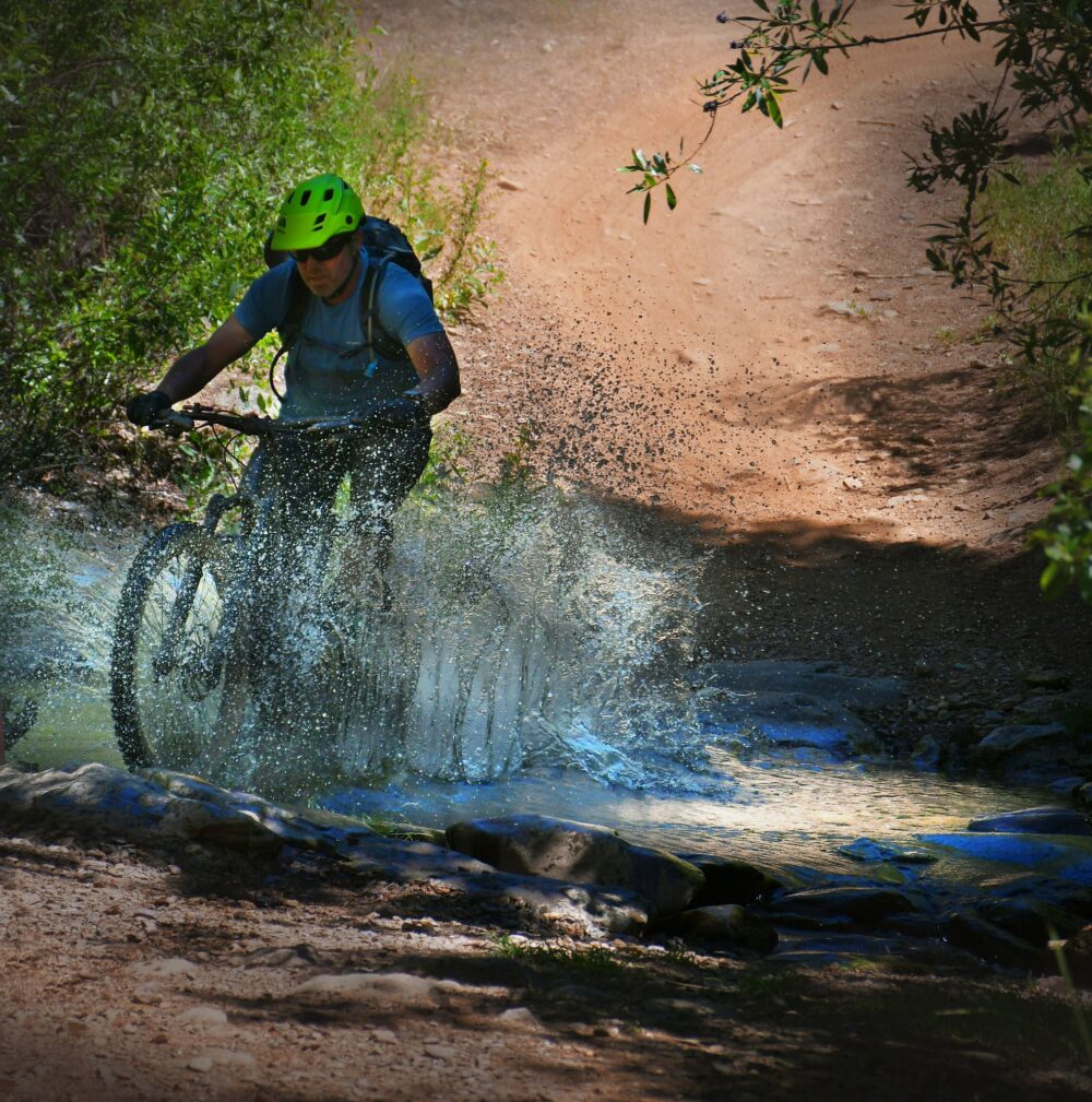
Plumas County is a popular spot for both road cyclists and mountain bikers. Within minutes of St. Bernard Lodge, you’ll find countless quiet backroads for road biking and an abundance of forested trails and logging roads perfect for mountain biking. If you are on a long-distance cycling trip, St. Bernard Lodge is the ideal place to spend the night. Please get in touch with us directly for more detailed information on all trails and routes, including directions, trail information, and road conditions. We are very informed about the area and happy to help however we can.

Call us at 530.258.3382 or ask for more information when you arrive.

St. Bernard Lodge will accept packages for PCT hikers and long-distance bicyclists. Please call the Lodge in advance to make arrangements for this service.

Sierra Cascades Bicycle Route

St. Bernard Lodge is approximately the halfway point for cyclists traveling the 2,396-mile-long Sierra Cascades Bicycle Route. This world-famous trail more or less follows the same route as the Pacific Crest Trail from Canada to Mexico, beginning in Sumas, Washington, and ending in Tecate, California. Section 3 runs from Crater Lake National Park to Truckee, California, and is 459 miles long. Highlights include:

  • Crater Lake
  • Ashland
  • McCloud Burney Falls
  • McArthur-Burney State Park
  • Old Station
  • Lassen Volcanic National Park
  • Lake Almanor
  • Quincy
  • Truckee

Please visit the Adventure Cycling Association for more details and maps on the routeAdventure Cycling Association. St. Bernard Lodge is located along Hwy 36, 15.2 miles east of Hwy 36/89 junction near the South entrance to Lassen and 10 miles west of Chester.

Road Cycling Routes

Road cycling is a great way to explore the area. There are many excellent road cycling routes near St. Bernard Lodge. Some of our favorites include:

  • Mill Creek Road (Hwy 172): Located about 13 miles from St. Bernard Lodge, Mill Creek Road from the Hanna Ranch to Mineral is 9 miles long. You’ll pass by the Mill Creek Resort, where drinks, snacks, and lunch are available in the summer. This route can be ridden as an out and back in either direction or as a loop traveling on Hwy 36 over Morgan Summit.
  • Lake Almanor Recreation Trail: This 12-mile paved trail runs along the west shore of Lake Almanor. It is 10 feet wide, making plenty of room for hikers and bicyclists. The trail can be accessed from several places. On the north end, a small dirt road crosses Humboldt Road. The southern point can be accessed from the Rocky Point boat launch area.
  • Last Chance Loop: This is primarily a flat loop around Lake Almanor’s upper and Last Chance Creek’s lower parts. The route includes 3 miles of pavement and 12 miles of gravel road. The Coffee Station or Bodfish Bicycles both make for good starting points.
  • Back Roads of Indian Valley: The Indian Valley Arm between Greenville and Taylorsville is a great back road that twists through the ranching country and is part of the Barn Quilt Tour. The distance is about 11.5 miles. Taylorsville has a great Country Store with a deli and a 100-plus-year-old cash register, which is still used today. There is also a tavern in town. You have several options from here: You can turn around and ride back to Greenville or continue to Genesee and ride the additional 24 miles to Antelope Lake. You can also take Taylorsville Road to Hwy 89 and head north on 89 back into Greenville. This route is about 14 miles.

Mountain Biking

There are many excellent opportunities for mountain biking in the Chester/Lake Almanor area. Routes vary from easy to challenging, so riders of all levels can find the right trail for them. Most routes are dirt or gravel roads, but a few single-track trails are not far from St. Bernard Lodge.

  • Morgan Summit: Beginning at the junction of Hwy 89/36 near the SW entrance to Lassen Park, you’ll find over 25 miles of dirt roads ranging from moderate to difficult. The parking area is located about 15 miles east of St. Bernard Lodge. In the winter, these trails are used by snowmobiles.
  • Spencer Meadows: Spencer Meadows Trail is a registered National Recreation Trail. The trailhead is on Hwy 36, just 11.5 miles west of St. Bernard Lodge. Spencer Meadow Trail is a 12-mile loop with an elevation climb of 2,410 feet. You can ride your bike to the boundary of Lassen National Park, but bicycles are not allowed on trails within Lassen Park boundaries.
    Sacramento River Bend Area: This area has two trails, the Iron Canyon Trail and Hog Lake Vista Trail. The trailheads are on the north side of Hwy 36, closer to Red Bluff. These trails are part of the BLM system.
  • Colby Mountain Lookout: This trail is 11.9 miles round trip. At 6,002 feet elevation, Colby Mountain Lookout is an active lookout. From the lookout, you’ll find breathtaking panoramic views of Lassen Peak.
  • Humbug Summit: This challenging 30.2-mile loop features an impressive 2,700-foot elevation climb. Humbug Summit is located in the Lassen National Forest. ATVs also use this route. The trailhead is located near Butte Meadows.
  • Humboldt Summit: 14.6 miles with 2,800 elevation gain. Humboldt Summit is also located in the Lassen National Forest—views of Lassen Peak from the trail.
  • Trail Lake Trail: Start at either Echo or Silver Lake and make a loop that includes FS10. Parts of the trail are fairly technical. The loop is 12.5 miles. There is also an out-and-back trail from Echo Lake to Trail Lake of 7.9 miles.
  • Bizz Johnson National Recreation Trail: The route runs from the Mason Station Trailhead north of Westwood to the Train Depot in Susanville. The trail is 25.4 miles one way and features 12 bridges and two tunnels. The trail is suited for mountain bikes or “fat tire” bicycles. Download the brochure and Map of Bizz Johnson Trail.
  • Fredonyer Peak Challenge: This route climbs 2,450 up the slope of Fredonyer Peak and is about 20 miles round trip. Fredonyer Peak has a working Lookout Tower at the top, so sign the guest book. Depending on your ability, allow a minimum of 4 hours. It may take up to 8 hours to complete. Make sure to plan time to enjoy the views from the lookout of Eagle Lake, Mt Shasta, Mt Lassen, and views of the High Desert to the east.
  • Bucks Creek Loop Trail: Near Bucks Lake, the trailhead for Bucks Creek Loop is on Forest Service Road 414 in the Plumas National Forest. The route is a 4.3-mile loop with a 400-foot elevation gain.
  • Quincy/Mount Hough: The Mount Hough Huff-n-Puff is a 20-mile round-trip route. It starts with a long 10-mile climb and an elevation gain of 3,704 feet. Views from the top are amazing. Mt. Lassen can be seen to the north and the Sierra Buttes to the south. The ride starts and stops at Feather River Camp.

Annual Bike Rides in the Area

  • Indian Valley Century Ride – usually in May
  • Mile High Century in Chester- Father’s Day Weekend
  • Courage Triathlon at Lake Almanor – August

Visit the events page for exact dates each year.

Other Information:

For More Information on Biking in Northern California, Chuck Elliot at Bodfish Quiet Mountain Sports is an excellent resource for more maps and tips on these routes, plus a few others in the area. If your bike needs repairs or a tune-up, he can also take care of you.

Phone: 530-258-2338

Bicycling Maps from Bodfish

More information on mountain biking trails can be found on the Plumas County Tourism website.

Trail Guide produced by Lassen National Forest. 

Trail Guide produced by Plumas National Forest. 

We have printed copies of these maps and guides at St. Bernard Lodge.

WINTER SPORTS

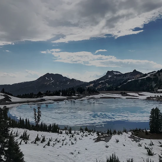
Lassen Volcanic Park and Lake Almanor are popular destinations for winter sports enthusiasts. The region boasts beautiful opportunities for cross-country Skiing, snowshoeing, snowmobiling, and more. Winter for us runs about 4-6 months per year, meaning the season is long and the opportunities for adventure are abundant. Many excellent trails for cross-country skiing and snowmobiling are easily accessible from the Lodge or Lassen Park and Lake Almanor.

Cross Country Skiing & Snowshoeing

Lassen Volcanic Park offers unparalleled skiing opportunities for both the relaxed skier and the expert looking for a challenge. There are miles of unmarked backcountry skiing available. The only marked trails are the Forest Lake Trail near the SW parking area and the Manzanita Lake Trail near the North entrance. The McGowan Trail is located just outside Lassen Park and is groomed by the Lassen National Forest. The trailhead is 2 miles north of the 89/36 junction. The trail is suitable for both beginners and advanced skiers.

Download the Winter Trail Guide for more information.

Some favorite spots for snowshoeing include:

  • Lake Almanor Recreation Area along the west shore of Lake Almanor
    The main park road to Sulphur Works and, for the more adventurous, up to Ridge Lakes or Brokeoff.
  • Roads behind St. Bernard Lodge

Snowmobiling

Plumas County and Lassen Volcanic Park boast some of the best snowmobiling in the entire state of California. Snowmobiling is the perfect way to enjoy a winter day in the Lassen National Forest and the Lake Almanor Basin. Experiencing the Sierras with a snowmobile is thrilling and can be enjoyed by the whole family. Snowmobile provides unbeatable access to the forest and allows you to explore places you might not otherwise be able. You’ll see incredible scenery and get up close and personal with the region’s abundant wildlife. It is a great activity with friends or a relaxing and thrilling way to escape the everyday demands of life. It varies yearly, but the snowmobile season is usually from mid-December to mid-March.

Snowmobiling West of the Lodge

  • Morgan Summit: Morgan Summit is about 20 minutes west of St. Bernard Lodge on Hwy 36. This snowmobile park offers 77 miles of designated trails, plenty of parking, a warming hut, and vault toilets.
  • Chester-Lake Almanor Snowmobile Park: The Chester-Lake Almanor Snowmobile Park is about 20 minutes east of St. Bernard Lodge at the intersection of A-13 and Hwy. 36. This snowmobile park offers miles of designated trails, plenty of parking, and vault toilets. This is also the staging area for the Chester Lake Almanor Snowmobile Annual Poker Run.
  • Swain Mountain: Swain Mountain is located about 10 miles east of Westwood and about 40 minutes from St. Bernard Lodge. There are 60 miles of designated trails with 3 different loops. Vault toilets are available.
  • Fredonyer: Fredonyer Snowmobile Park is 12 miles east of Westwood. There are 90 miles of trails and three loops. Vault toilets are available.
  • Jonesville: The main staging area for the Jonesville Snowmobile Park is on Humboldt Road past Butte Meadows. For guests staying at St. Bernard Lodge, the snowmobile park can be accessed from near Cedar Lodge on Hwy 89. You’ll find a warming complex located halfway between Jonesville and Chester.

Basic Trail Manners and Safety Tips

  • Always travel with someone else. Let someone know where you will be and when you plan on returning. Do not count on your cell phone working.
  • Learn basic hand gestures to get the attention of others before going out on a snowmobile. Snowmobiles can be loud and it is difficult to hear.
  • Please be courteous and slow snowmobiles to a minimum when you are near skiers, snowshoers, or wildlife.
  • Please do not take wheeled vehicles on groomed trails.
  • Please do not snowmobile to trails designated for XC skiers and snowshoers only.
  • Practice Leave No Trace. Make sure to take out anything that you brought into the forest. If possible, remove trash others have left behind.
  • Avoid riding over small trees and bushes.
  • Check updated weather and avalanche report from the Forest Service or other agency before heading out.
  • Do not chase or harass animals in the forest.
  • Unforeseen events may occur. Be prepared with survival supplies and knowledge of how to build a snow cave.
  • Have fun!

St. Bernard Lodge will be happy to keep you updated on current snow and trail conditions. Please call 530-258-3382.

HIKING

The area surrounding St. Bernard Lodge offers unparalleled hiking opportunities. We offer detailed maps, directions, and trail guides at St. Bernard Lodge and are more than happy to help you find the proper hike. From the gorgeous peaks of Lassen Volcanic National Park to the ice caves at Wilson Lake, here are some of our favorite hikes in the region.

Indian Valley/Greenville Area

  • Round Valley Nature Walk: Round Valley Lake Nature Walk takes you on a lovely one-mile loop around the Round Valley Reservoir. Typically a cool, shaded hike is a great route to take if the weather is extremely warm in the area. It is also an excellent lake for canoes and kayaks. Swimming and motorized boats are not permitted in the lake.
  • Indian Falls: Indian Falls is about nine miles south of Greenville on the east side of Hwy. 89. A short 10-minute walk will take you to a secluded beach area and a lovely waterfall. Due to its quiet and peaceful atmosphere, it is easy to understand why this was a sacred place for the Maidu Indians. If you would like to learn more about the Maidu Indians, keep an eye out for the signage along the way explaining a bit about their history and culture.

Hikes Near Chester and Lake Almanor

  • Lake Almanor Recreation Trail: This pleasant, paved trail runs along the west shore of Lake Almanor for about 12 miles. Hiking or biking the Lake Almanor Recreation Trail gives you beautiful views of Lake Almanor, Dyer Mountain, and a few breathtaking glimpses of Lassen Peak. This is also an excellent trail for spotting Bald Eagles, Osprey, and various other birds.
  • Collins Pine Nature Trail: The trail starts at the west end of Chester Park and loops through beautiful second-growth woodlands. Plan to stop at the Collins Pine Museum before starting this hike.
  • Locherman Canyon Nature Trail: Also known as the Mike McCollum Nature Trail, the trailhead is located 5 miles north of the Hwy. 36/89 junction just west of Chester. Start at the Amphitheater and follow the loop, which is a little over ½ mile. The trail passes through several different habitats and twelve different points of interest.

Closest Trails to St. Bernard Lodge

  • Pacific Crest Trail: The world-famous PCT is located 1.4 miles east of St. Bernard Lodge. The trail can be hiked in either direction from here. Hiking north, about 7 miles, will take you to Stover Springs. Hiking south, you will cross Soldier Meadows and climb Carter Mountain.
  • Spencer Meadow National Recreation Trail: The Spencer Meadow Trailhead is about 11 miles west of St. Bernard Lodge on the north side of Hwy. 36 before you reach Childs Meadow.

Hikes East of Chester and St. Bernard Lodge

  • Bizz Johnson National Recreation Trail: Part of the historic rails-to-trails conservation project, the Bizz Johnson National Recreation Trail has been rated the most scenic trail in all of California. This hike is especially magical when you can experience the fantastic changing colors in the fall. The trail is open to mountain bikes, horseback riders, and hikers. For more information, download the brochure and directions.
  • Osprey Trail and Overlook: This ½ mile trail begins just after Camp Ronald McDonald and offers incredible views of Eagle Lake along the way. You’ll start at the osprey’s nest near the trailhead. There are interpretive signs along the way where you can learn more about the osprey and eagles in the area. The views on this hike are amazing, so be sure to bring your camera.

Caves

If you’ve seen enough beautiful sites above ground, why not head below? We are located near three caves for those of you interested in exploring the underground.

  • Wilson Lake Ice Caves: Though these caves are hard to find, you will be rewarded once you do. The caves are small with wondrous, with a 150-foot rope to help you down. We recommend going in the spring if you want to see the ice in the caves.
  • Hamilton Branch Caves: A longtime local secret, the Hamilton Branch Caves became a popular caving spot after a Feather River College student shared information about them with the public. The entrance is located about 2 miles from Hamilton Branch at Lake Almanor. This accessible, two-level cave does not require headlamps.
  • Subway Caves: A dense flow of lava formed the Subway Caves nearly 20,000 years ago. The height of the cave varies from 6 to 17 feet, so be sure to take a flashlight or headlamps. For more information, view the PDF for Subway Caves.

FISHING

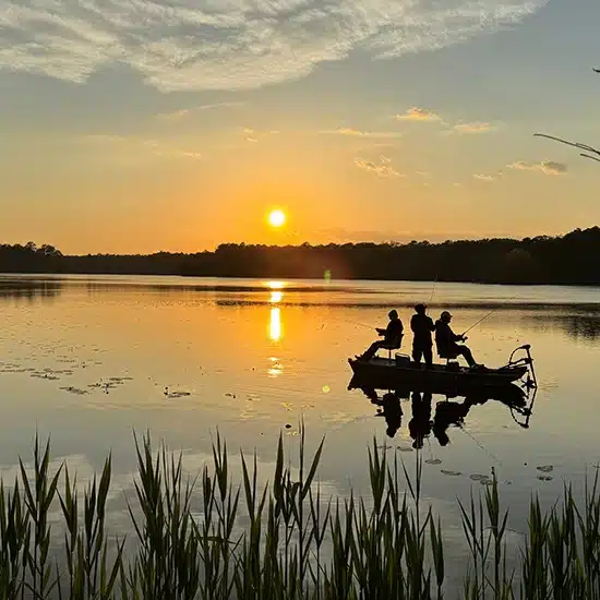
For the angler, we offer stream fishing in Deer Creek, just minutes from the Lodge. We can tell you the best spots to try. The Lodge is also minutes away from Lake Almanor and Butt Lake. Eagle Lake and Antelope Lake are about one hour away and are great fishing venues. Lassen Park has several great lakes to fish.

Serious and not-so-serious fishermen rave about Lake Almanor. Lake Almanor is one of the largest man-made lakes in California and the largest in Plumas County, with 52 miles of shoreline. The Lake is renowned for trout and smallmouth bass. Lake Almanor is known worldwide for the Hexegenia Hatch from June to early July. Fishing during the Hex Hatch is a unique experience not to be missed. Several great fishing guides are available to take you fishing on the Lake. Many provide everything you need except a fishing license.

Close by is Butt Lake, with 12 miles of shoreline. Brown trout and Rainbow trout can be fished in the Lake. There is a small boat launch. Jet skiing and waterskiing are not allowed, making for a quieter lake than Lake Almanor for fishing, kayaking, and swimming.

Antelope Lake is about one hour from the Lodge and straddles both Lassen and Plumas Counties. Antelope Lake has 14 miles of shoreline, and rainbow, brown, and eagle lake trout can all be caught here. Fishing in Indian Creek beneath the spillway of Antelope Dam usually has good fishing. This lake is stocked yearly by Fish and Game. Jet skis and waterskiing are allowed on Antelope Lake.

Eagle Lake is a favorite of many fishermen for Eagle Lake Trout, which at one time could only be found at Eagle Lake. Fish and Game has since started stocking eagle lake trout in other California Lakes. Eagle Lake is the second largest natural lake in California, with over 100 miles of shoreline. Besides great fishing, Eagle Lake is known for a large variety of birds. Both golden and bald eagles can be found nesting. There is a ½ mile trail from Gallatin Beach to Osprey Overlook. The Overlook offers you views of Eagle Lake and nesting Osprey. Watching an eagle or osprey catch a fish is a memorable sight.

Lassen Park offers a variety of lakes to fish. A few of the more popular lakes are Butte Lake, near the Cinder Cone Trailhead, and Snag Lake, about 3.5 miles from Butte Lake. There is hiking along the edge of the Fantastic Lava Beds. Horseshoe Lake is in the SE part of Lassen Park. The trailhead is near Juniper Lake. Just follow the trail for about 1.5 miles to Snag Lake. Snag Lake and Horseshoe Lake will be for you if you are looking for solitude.

The most popular and most accessible Lake to reach is Manzanita Lake, near the park’s North entrance. This is a catch-and-release-only lake. This is a great lake to take the kids fishing. Kayak rentals are available in the summer from Cal Parks Co.

LASSEN VOLCANIC PARK

Lassen Volcanic Park is Northern California’s under-the-radar gem. The park has every outdoor activity a nature lover could dream of, from gorgeous mountains and alpine lakes to boiling geothermal areas and beautiful, flower-filled meadows. The park offers visitors countless natural wonders and adventures without the crowds and expensive entrance fees of more well-known destinations like Shasta or Yosemite. Come to Lassen Volcanic park for unparalleled opportunities for hiking, horseback riding, fishing, camping, nature photography, geocaching, stargazing, and so much more. It also boasts some of the best Ranger Programs in the entire country. Best of all, St. Bernard Lodge is located just 20 minutes away from the SW entrance. With so much to do and see within the park, many of our guests come back to this area year after year just so they can experience it all.

Visitor Center

The park’s new and improved Visitor Center is located at the south entrance of Lassen Volcanic National Park. It is named Kohm Yah-mah-nee, which is the Mt. Maidu name for Snowy Mountain (Lassen Peak). The Visitor Center features an auditorium showing a short film about the park’s history and sights. There are also hands-on interpretive exhibits and displays for all ages. The Visitor Center is open seven days a week from 9:00 am – 5:00 pm and will give you an excellent overview of the Park. The Park Rangers are available to give you up-to-date information on trail conditions. This building is believed to be the first LEED-certified visitor center in the National Park Services.

Volcanoes & Geothermal Areas

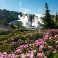
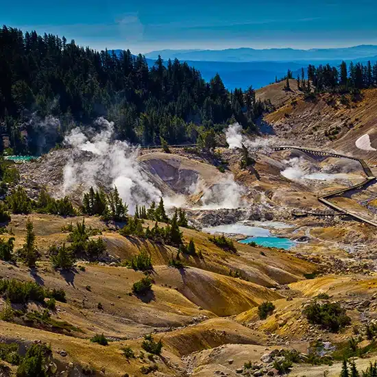
Lassen Park is the only National Park with all four types of volcanoes–Shield, Composite, Cinder Cone, and Plug Dome–within park boundaries. In fact, Lassen Peak is the largest Plug Dome volcano in the world. Lassen Volcanic Park’s fascinating eruptive history has dramatically shaped the area’s landscape, creating a variety of geothermal areas like roiling fumaroles, mud pots, boiling pools, and steaming ground.

To view the park’s best geothermal areas, we recommend combining one or two of the following day hikes: Devil’s Kitchen, Boiling Springs Lake, and/or Terminal. All three hikes can be completed in one day by serious hikers. With its low elevation and flat surface, Devil’s Kitchen is one of the easier hikes in the park. This 4.2-mile hike is the second-largest geothermal area in the park and rewards you with some very interesting mud pots at the end.

Boiling Springs Lake is an easy 1.8 miles hike that takes you through the largest active geothermal feature in Lassen Park. In addition, it is one of the largest hot-water lakes in the world. Many visitors to the lake are surprised by its interesting sea-green color. Steam vents heat the water beneath the lake, which keeps it at an impressive 125 degrees.

Other unique geothermal areas include Terminal Geyser, about 4.4 miles round trip from the Willow Lake Campground

Bumpass Hell is the largest geothermal area west of Yellowstone. This hike is from the main park Highway. The Bumpass Hell parking lot is also an excellent place to stargaze after dark.

If you visit the Northeast corner of the park, consider hiking Cinder Cone, a 350-year-old volcano. You’ll get a chance to view the gorgeous painted dunes and look down into an actual volcano. The serious hiker can add in Prospect Peak, a shield volcano that looks down on Cinder Cone.

Drakesbad

You’ll find the charming and historic Drakesbad Guest Ranch at the South East corner of Lassen Volcanic Park. This is an excellent spot for hiking and horseback riding. Advanced reservations are required for horseback, but with a reservation, you can enjoy lunch and dinner as well as a refreshing soak in their mineral hot spring pool.

Other Hikes

  • Brokeoff
  • Mill Creek Falls
  • King Creek Falls
  • Lassen Peak
  • Hat Creek Rim Overlook
  • Subway Caves
  • Spattercone

Free Entrance Days

  • Martin Luther King Jr. Day
  • First Day of National Park Week
  • National Park Service Anniversary
  • National Public Lands Day
  • Veteran’s Day
  • Ranger-Led Programs For Kids! Junior Ranger Program
  • Ranger-led Snowshoe Walks
  • Cross Country Ski Tours
  • Astronomy Guides

CRATER LAKE NATIONAL PARK

Driving from Lassen Park to Crater Lake National Park

Crater Lake National Park is located in southern Oregon, about a half days ride from Lassen Volcanic National Park in northern California. The drive from St. Bernard Lodge to Crater Lake is slightly over 200 miles.

Crater Lake National Park is open year-round and is considered by many to be the snowiest place in the Northwestern United States. Over 500 inches of snow drops annually, allowing for magnificent vistas, backcountry camping and hiking in old-growth forests, snowshoeing, and cross-country skiing. The most popular attraction, however, is Crater Lake.

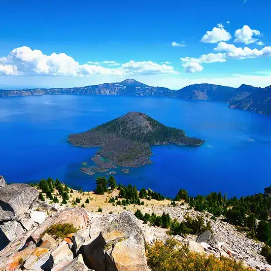
Crater Lake is a caldera lake which is a cauldron-like feature that was formed when the Mount Mazama volcano erupted and then collapsed on itself and the land around it almost 7,700 years ago. The Crater Lake caldera is 6 miles wide, is the deepest lake in the United States at 1,932 feet, and 7th deepest lake in the world.

It is known for its deep blue color, impeccable water clarity, and the Old Man of the Lake, a full-sized tree that has bobbed in the middle of Crater Lake consistently and reliably for over 100 years. There are no inlets or outlets to Crater Lake.

The water in Crater Lake has a greater UV transparency than any other natural body of water in the world. Light penetrates up to depths of 320 feet on a regular basis.

A great way to see Crater Lake is via a boat tour. The only legal way to access the shore of Crater Lake is via the 1.1-mile Cleetwood Cove Trail. This is a strenuous trail with an 11% grade.

Suggested taking 33-mile Rim Drive when visiting Crater Lake. Do not want to miss Phantom Rock or Wizard Island.

Lodging and Accommodations for Travelers to Crater Lake National Park and Other National Parks

For travelers exploring other National Parks in the vicinity of Crater Lake, make sure to add Lassen Volcanic National Park to your list. When visiting Lassen Park, consider St. Bernard Lodge in Mill Creek, CA, as the perfect B&B and inn stopover for singles, couples, families, and groups to stay, rest in rustic comfort, and eat drink great food.

St. Bernard Lodge in Mill Creek is minutes from Lassen Volcanic National Park and is a central lodging and bed and breakfast location for travelers en route from/to Lake Tahoe or other surrounding National Parks such as Lassen, Yosemite National Park, or Redwood National Park.

St. Bernard Lodge is a beautiful rustic inn whose second floor has seven rooms and can sleep up to 20 guests. The restaurant and tavern on the first floor can feed up to 50 diners which means that those coming into Lassen to camp or with RVs can also be seated comfortably. You can call us at 530.258.3382 to reserve, or feel free to reserve online.

Crater Lake National Park Map and Directions

Click on the following link for a map and directions from Crater Lake National Park in Oregon to St. Bernard Lodge in Mill Creek, CA. Lassen Volcanic National Park in Mineral, CA, is only a 20-minute drive from the Lodge.

Crater Lake National Park Location

Crater Lake National Park is located in southern Oregon, about an hour north northeast of Medford in the Cascade Range. Crater Lake is about a 5 ½ hour drive from Lassen Volcanic National Park in northern California and only 10 ½ hours to Yosemite National Park. The closest major airport is Eugene Airport, located in Eugene, Oregon. The airport is about 120 miles northwest of the Park.

Things to See on your Drive from Crater Lake to St. Bernard Lodge

Collier Memorial Park is an excellent place to get out and stretch your legs. It’s 30 miles north of Klamath Falls on U.S. Highway 97. Collier Memorial Park is an outdoor museum of historic logging equipment and a relocated pioneer village.

The Lava Bed National Monument is south of Klamath Falls, off of Hwy 139. This is a great place to stop if you are into caves and geological features. Visitors are able to explore dozens of developed caves on their own. Guided tours are available in the summer months. Make sure to bring a flashlight and be prepared for cool temperatures in the caves. Year-round temperatures in the caves are about 55 degrees F or 13 degrees C.

One of the least challenging caves is Mushopt Cave and the only lighted cave. A moderate challenge is the Sunshine Cave. If you are really into cave crawling, try Labyrinth Cave and Lava Brook Cave. Park’s contact number is 530-667-8100.

McArthur-Burney Falls Memorial State Park has one of the most beautiful waterfalls in the state. Burney Falls is 129 feet tall. Pacific Crest Trail passes through the Park. The Park is located off Hwy 89, eleven miles north of Burney. You can take either the 1-mile or 2.4-mile loop to see the falls. Burney Falls is about two hours from St. Bernard Lodge and well worth a quick stop if driving by.

Subway Cave, located in Lassen National Forest off Hwy 89, is a fun stop. The Cave is a lava tube that was formed some 2000 years ago. It extends 1300 feet. This is an easy lava tube to explore for both young and old alike. Once again, you need a flashlight; the cave temperature is about 55 degrees F year-round. Admission to this cave is FREE. From here, you are only about an hour’s drive to St. Bernard Lodge.

Crater Lake National Park Address
Crater Lake National Park
PO Box 7
Crater Lake, OR 97604-0007
Phone: 541-594-3100
TDD: 541-594-2261
Fax: 541-594-3010

You can call us at 530.258.3382 to reserve, or feel free to reserve online.

REDWOOD NATIONAL AND STATE PARKS

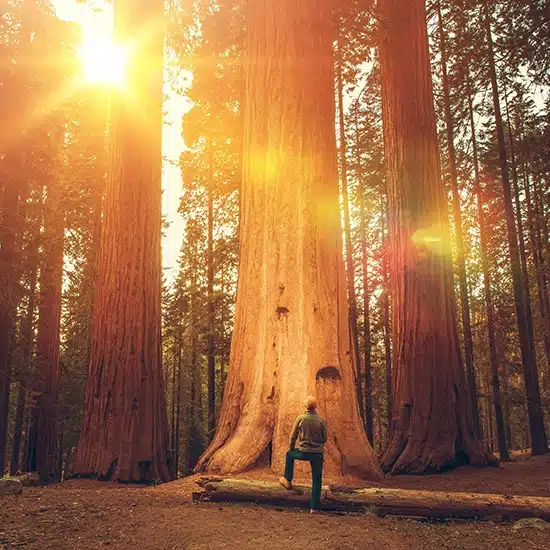
Redwoods are the tallest trees on Earth, with lengths in excess of 300 feet. But it usually takes 200 years for redwoods to grow that tall. Redwoods are thought to be the oldest trees on Earth as well, but that isnít so. The oldest Bristlecone Pine tree in the Sierra Nevada mountain range is 4,500 years old.

There are three types of redwoods: The coast redwood is located in Redwood National Park along the pacific coast of the United States. The giant sequoia is located inland in the Sierra Nevada Mountains of California, and the deciduous dawn redwood is located in China and is diminutive by comparison growing to about 115 feet in height.

In addition to the giant redwood trees, Redwood National Park also protects fauna, flora, prairie, rivers, streams, and, of course, the coastline from development.

Lodging and Accommodations for Travelers to Redwood National Park and Other National Parks

Many travelers enjoy visiting and experiencing the different outdoor activities available in the National Parks in California and Oregon because of the short drives involved. For example, driving from Redwood National Park to Lassen Volcanic National Park is less than 6 hours in a car; Redwood to Yosemite is only a full day drive at 10 ½ hours. However, the trick of traveling is to not arrive at your locale tired and hungry.

For travelers exploring the National Parks north, east and southeast of Redwood National and State Parks, St. Bernard Lodge in Mill Creek, CA is the best bet for lodging for travelers en route from Redwood National Park to other National Parks such as Lassen Volcanic National Park, Crater Lake National Park, or Yosemite National Park.

St. Bernard Lodge, a rustic bed and breakfast, offers inn-like qualities. It is 20 minutes from Lassen Volcanic National Park in Mineral, CA. It is a historic, rustic, and hugely popular bed and breakfast inn where people and groups of all sizes and from all areas of the world come to mingle, stay, take a load off, and enjoy a wonderful home-cooked meal with new friends.

The historic, wooden, and rustic feel of the lodge gives St. Bernard that inn-like feel, and the family and caring attitudes of the owners give it the bed and breakfast feel. The second floor of St. Bernard Lodge is where all the bedrooms are – 7 rooms total, sleeping 20 guests. The first floor is where all of the meals are served. The restaurant and tavern can accommodate 35 diners so that guests with RVís parked outside can enjoy a home-cooked meal and warm rustic comfort. Call us at 530.258.3382 to reserve your stay, or feel free to reserve online.

Redwood National Park Map and Directions

View map and directions from Redwood National and State Parks in Crescent City, California (CA coastline) to St. Bernard Lodge in Mill Creek, CA. Mount Lassen Volcanic National Park in Mineral, CA, is only a 20-minute drive from the Lodge.

Redwood National Park Location
Redwood National and State Parks is located all along the northern California coastline beginning in the southern city of Trinidad and ending in the northern California city of Klamath Glen to the north.

Redwood National Park is a 10 ½ hours drive from Yosemite National Park and under 6 hours to Lassen Volcanic National Park. St. Bernard Lodge is right in between.

Redwood National and State Parks Address
Redwood National Park
1111 Second Street
Crescent City, CA 95531
Phone: 707-465-7306
Fax: 707-464-1812
TDD: 800-423-6101

You can call us at 530.258.3382 to reserve, or feel free to reserve online.

Points of Interest between Redwood National Park and St. Bernard Lodge

“Joss House” in Weaverville is a Chinese Taoist temple and California’s oldest continuously used Chinese temple. Park Brochure.

Whiskeytown National Recreation Area

Nice stop to view the lake and a short walk to Mill Creek Falls or a longer hike to Whiskeytown Falls. Nice beach area to take a quick swim on a hot day. The Camden House Historic District is within the Whiskeytown Recreation area and a great place for a picnic. The 7-day pass to Whiskeytown also gets you into Lassen Park. The seven-day pass from Lassen Park will get you into Whiskeytown.

Shasta State Historic Park

The Historic Park was once the gold-mining town of Shasta. The park is made up of several historic buildings. Park Brochure.

Sundial Bridge

The Sundial Bridge is the world’s longest, glass-surfaced, cable-stayed suspension pedestrian bridge, and the largest working sundial. It was built to not interfere with the Salmon coming upstream in the Sacramento River. Webcam of Bridge.

Turtle Bay Museum

The Turtle Bay Museum is just off the south side of the Sundial Bridge. It has excellent displays for kids. One of the permanent and exciting displays is the underwater fish viewing of fish in the Sacramento River.

The William B. Ide Adobe State Historic Park

This park is just off of I-5 in Red Bluff. It was the home of the only president of the California Republic. Park Brochure.

You may not want to make all of these stops between St. Bernard Lodge and the Redwoods; you may want to pick one or two, depending on your interests. Most of Hwy 299 is a two-lane Highway. Take your time and enjoy.

LAKE ALMANOR

Lake Almanor is located in Plumas County in northern California, just a few minute’s drive southeast of  Lassen Volcanic National Park in Mineral, California, and just due east from St. Bernard Lodge in Mill Creek.

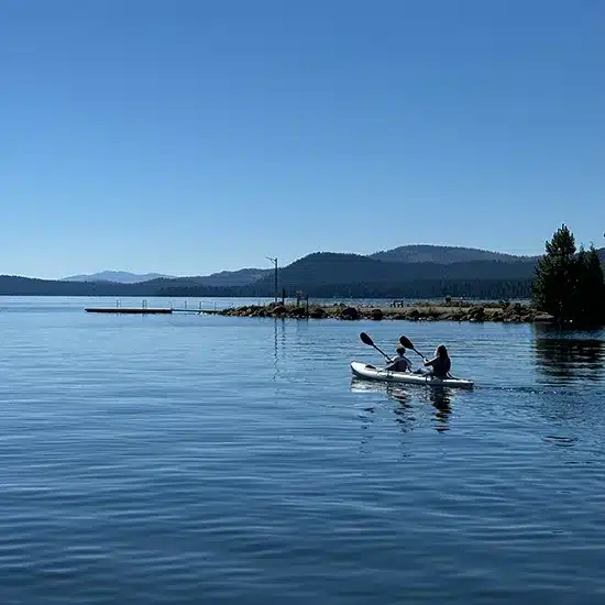
If you have set aside a couple of days while visiting Lassen Volcanic National Park or need some rest and relaxation from your tour of the national parks in the vicinity of Lassen, make sure to take a half or full day to enjoy the beauty and outdoor sports that Lake Almanor offers. It is the second largest manmade lake in California. Lake Almanor has excellent fishing, with fishing guides available year-round. In the summer, it is a go-to lake for many for fishing, boating, kayaking, swimming, and just relaxing. Lake Almanor is at the top of the watershed and has not been negatively affected by the drought as Shasta and Lake Oroville.

Lake Almanor came into being in 1914 when the Great Western Power Company dammed the north fork of the Feather River. Before this, the Maidu Indians called it ìoy-ding-koyoî or Big Meadows. In 1848 Peter Lassen led a party through Big Meadows. At one time, there were many dairies and ranches dotted along the meadows. Now Lake Almanor is one of the largest man-made lakes in California and the largest in Plumas County. The Lake is 13 miles long and 6 miles wide, containing 52 miles of shoreline. Water temperature in the summer reaches 75 degrees F, which makes it great for water sports.

The Lake Almanor Recreation Trail runs nine and one-half miles along the west side of Lake Almanor. It is a terrific trail for snowshoeing in the winter. It is a nice trail for an easy family hike or biking excursion in the summer. From the trail, there are several places to stop and take in the spectacular views of Lake Almanor, Dyer Mountain, and Mt. Lassen. The Trail is 10 feet wide and paved, making it comfortable for both bicyclists and hikers.

The Lake Almanor Basin is known for one of the largest known breeding populations of Osprey in the Western States. It is not uncommon to spot Osprey in a nest or circling the lake to catch fish.

Enjoy Outdoor Sports, Hiking, and Camping at Lake Almanor

In the Winter, you can enjoy snowmobiling, cross-country skiing, Christmas tree cutting, and snowshoeing. In the summer months, you can golf, hike, bike, camp, and fish. Since Lake Almanor has 52 miles of shoreline, it is a mecca for water sports like boating, swimming, water skiing, jet skiing, and float tubing.

Lake Almanor Lodging and Accommodations

St. Bernard Lodge is a central and unique Lassen and Lake Almanor lodging location for travelers en route from/to other surrounding National Parks such as Lassen Volcanic National Park, Crater Lake National Park in Oregon, Yosemite National Park, or Redwood National Park.

St. Bernard Lodge is a beautiful rustic inn-style bed and breakfast (B&B) whose second floor has seven rooms and can sleep up to 20 guests. The restaurant and tavern on the first floor can feed up to 35 guests. St. Bernard Lodge accepts RVs, and campers are invited to explore the many campgrounds within 10 miles of the Lodge.

Lake Almanor Map and Directions

View map and directions from Lake Almanor to St. Bernard Lodge in Mill Creek, CA. Lassen Volcanic Park in Mineral, CA, is only a 20-minute drive from the Lodge.

You can call us at 530.258.3382 to reserve, or feel free to reserve online.

Scroll to Top