Biking
The Best Biking Routes in Northern California
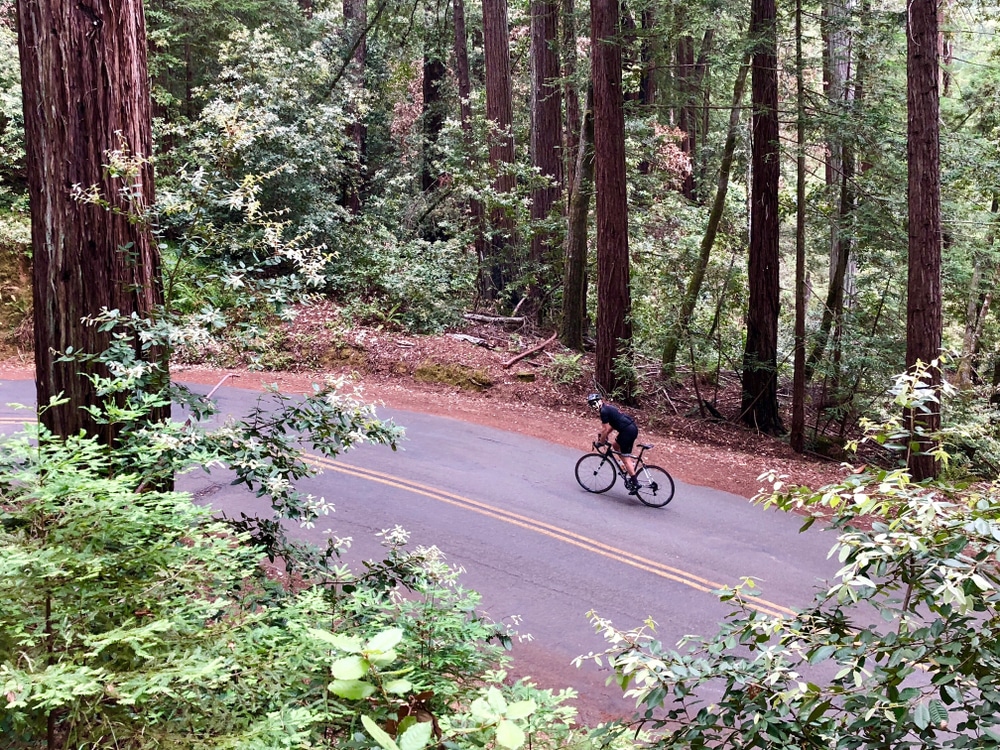
Plumas County is a popular spot for both road cyclists and mountain bikers. Within minutes of St. Bernard Lodge, you’ll find countless quiet backroads for road biking and an abundance of forested trails and logging roads perfect for mountain biking. If you are on a long-distance cycling trip, St. Bernard Lodge is the ideal place to spend the night. Please get in touch with us directly for more detailed information on all trails and routes, including directions, trail information, and road conditions. We are very informed about the area and happy to help however we can.
Call us at 530.258.3382 or ask for more information when you arrive.
St. Bernard Lodge will accept packages for PCT hikers and long-distance bicyclists. Please call the Lodge in advance to make arrangements for this service.
Sierra Cascades Bicycle Route
St. Bernard Lodge is approximately the halfway point for cyclists traveling the 2,396-mile-long Sierra Cascades Bicycle Route. This world-famous trail more or less follows the same route as the Pacific Crest Trail from Canada to Mexico, beginning in Sumas, Washington, and ending in Tecate, California. Section 3 runs from Crater Lake National Park to Truckee, California, and is 459 miles long. Highlights include:
- Crater Lake
- Ashland
- McCloud Burney Falls
- McArthur-Burney State Park
- Old Station
- Lassen Volcanic National Park
- Lake Almanor
- Quincy
- Truckee
Please visit the Adventure Cycling Association for more details and maps on the routeAdventure Cycling Association. St. Bernard Lodge is located along Hwy 36, 15.2 miles east of Hwy 36/89 junction near the South entrance to Lassen and 10 miles west of Chester.
Road Cycling Routes
Road cycling is a great way to explore the area. There are many excellent road cycling routes near St. Bernard Lodge. Some of our favorites include:
- Mill Creek Road (Hwy 172): Located about 13 miles from St. Bernard Lodge, Mill Creek Road from the Hanna Ranch to Mineral is 9 miles long. You’ll pass by the Mill Creek Resort, where drinks, snacks, and lunch are available in the summer. This route can be ridden as an out and back in either direction or as a loop traveling on Hwy 36 over Morgan Summit.
- Lake Almanor Recreation Trail: This 12-mile paved trail runs along the west shore of Lake Almanor. It is 10 feet wide, making plenty of room for hikers and bicyclists. The trail can be accessed from several places. On the north end, a small dirt road crosses Humboldt Road. The southern point can be accessed from the Rocky Point boat launch area.
- Last Chance Loop: This is primarily a flat loop around Lake Almanor’s upper and Last Chance Creek’s lower parts. The route includes 3 miles of pavement and 12 miles of gravel road. The Coffee Station or Bodfish Bicycles both make for good starting points.
- Back Roads of Indian Valley: The Indian Valley Arm between Greenville and Taylorsville is a great back road that twists through the ranching country and is part of the Barn Quilt Tour. The distance is about 11.5 miles. Taylorsville has a great Country Store with a deli and a 100-plus-year-old cash register, which is still used today. There is also a tavern in town. You have several options from here: You can turn around and ride back to Greenville or continue to Genesee and ride the additional 24 miles to Antelope Lake. You can also take Taylorsville Road to Hwy 89 and head north on 89 back into Greenville. This route is about 14 miles.
Mountain Biking
There are many excellent opportunities for mountain biking in the Chester/Lake Almanor area. Routes vary from easy to challenging, so riders of all levels can find the right trail for them. Most routes are dirt or gravel roads, but a few single-track trails are not far from St. Bernard Lodge.
- Morgan Summit: Beginning at the junction of Hwy 89/36 near the SW entrance to Lassen Park, you’ll find over 25 miles of dirt roads ranging from moderate to difficult. The parking area is located about 15 miles east of St. Bernard Lodge. In the winter, these trails are used by snowmobiles.
- Spencer Meadows: Spencer Meadows Trail is a registered National Recreation Trail. The trailhead is on Hwy 36, just 11.5 miles west of St. Bernard Lodge. Spencer Meadow Trail is a 12-mile loop with an elevation climb of 2,410 feet. You can ride your bike to the boundary of Lassen National Park, but bicycles are not allowed on trails within Lassen Park boundaries.
Sacramento River Bend Area: This area has two trails, the Iron Canyon Trail and Hog Lake Vista Trail. The trailheads are on the north side of Hwy 36, closer to Red Bluff. These trails are part of the BLM system. - Colby Mountain Lookout: This trail is 11.9 miles round trip. At 6,002 feet elevation, Colby Mountain Lookout is an active lookout. From the lookout, you’ll find breathtaking panoramic views of Lassen Peak.
- Humbug Summit: This challenging 30.2-mile loop features an impressive 2,700-foot elevation climb. Humbug Summit is located in the Lassen National Forest. ATVs also use this route. The trailhead is located near Butte Meadows.
- Humboldt Summit: 14.6 miles with 2,800 elevation gain. Humboldt Summit is also located in the Lassen National Forest—views of Lassen Peak from the trail.
- Trail Lake Trail: Start at either Echo or Silver Lake and make a loop that includes FS10. Parts of the trail are fairly technical. The loop is 12.5 miles. There is also an out-and-back trail from Echo Lake to Trail Lake of 7.9 miles.
- Bizz Johnson National Recreation Trail: The route runs from the Mason Station Trailhead north of Westwood to the Train Depot in Susanville. The trail is 25.4 miles one way and features 12 bridges and two tunnels. The trail is suited for mountain bikes or “fat tire” bicycles. Download the brochure and Map of Bizz Johnson Trail.
- Fredonyer Peak Challenge: This route climbs 2,450 up the slope of Fredonyer Peak and is about 20 miles round trip. Fredonyer Peak has a working Lookout Tower at the top, so sign the guest book. Depending on your ability, allow a minimum of 4 hours. It may take up to 8 hours to complete. Make sure to plan time to enjoy the views from the lookout of Eagle Lake, Mt Shasta, Mt Lassen, and views of the High Desert to the east.
- Bucks Creek Loop Trail: Near Bucks Lake, the trailhead for Bucks Creek Loop is on Forest Service Road 414 in the Plumas National Forest. The route is a 4.3-mile loop with a 400-foot elevation gain.
- Quincy/Mount Hough: The Mount Hough Huff-n-Puff is a 20-mile round-trip route. It starts with a long 10-mile climb and an elevation gain of 3,704 feet. Views from the top are amazing. Mt. Lassen can be seen to the north and the Sierra Buttes to the south. The ride starts and stops at Feather River Camp.
Annual Bike Rides in the Area
- Indian Valley Century Ride – usually in May
- Mile High Century in Chester- Father’s Day Weekend
- Courage Triathlon at Lake Almanor – August
Visit the events page for exact dates each year.
Other Information:
For More Information on Biking in Northern California, Chuck Elliot at Bodfish Quiet Mountain Sports is an excellent resource for more maps and tips on these routes, plus a few others in the area. If your bike needs repairs or a tune-up, he can also take care of you.
Phone: 530-258-2338
More information on mountain biking trails can be found on the Plumas County Tourism website.
Trail Guide produced by Lassen National Forest.
Trail Guide produced by Plumas National Forest.
We have printed copies of these maps and guides at St. Bernard Lodge.