Best Hiking Trails along Highway 36 south of Lassen Park
June 20, 2017 by: Sharon Roberts
Great trails less than 30 minutes from St. Bernard Lodge
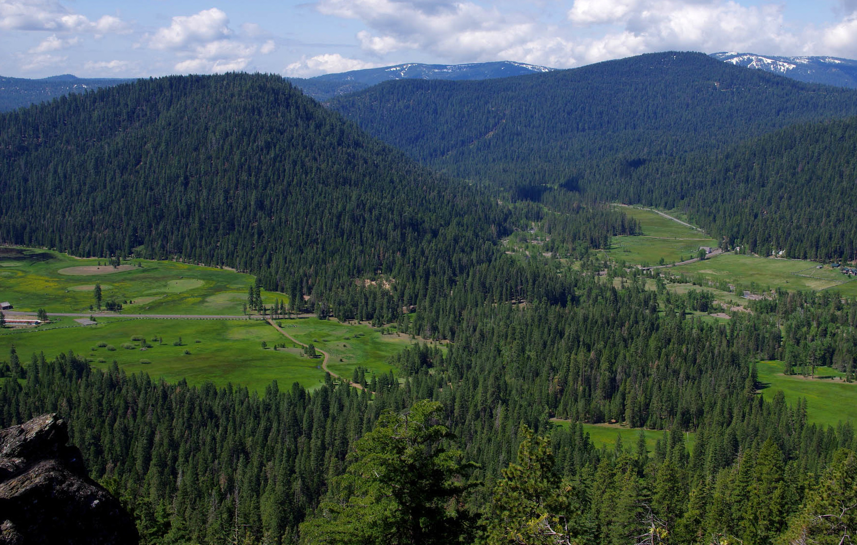
Highway 36 south of Lassen Park features several excellent hiking trails, including the Spencer Meadows Trail, Deer Creek Trail, Almanor Recreation Trail, and the Bizz Johnson Trail. And while snow often blankets the high surrounding mountains, these trails are snow-free much of the year.
Spencer Meadow National Recreation Trail
Round-trip distance: 13.0 miles
High point: 6600 feet
Elevation gain: 2150 feet
Season: June to October
Difficulty: 4 on a 1-5 scale
Contact: Almanor Ranger District, Lassen National Forest
Driving directions: Find the trailhead and its large parking area on the north side of CA Highway 36 about 5.0 miles east of junction of Highways 36 and 89, 0.3 mile east of Childs Meadows Resort, and 7.2 miles northwest of the junction of Highways 36 and 32.
Driving time from St. Bernard Lodge: 10 minutes
Beautiful forest, lush meadows, a waterfall: there’s a lot to love about this hike, especially if you enjoy vigorous climbing. Because the trailhead is on Highway 36 at a relatively low elevation, you can do at least the lower reaches even in late fall and early spring, as long as there’s no snow.
Start climbing in a mixed forest of ponderosa pine, incense cedar, and white fir, along with a few sugar pine and black oak. At 0.6 mile you’ll cross a seasonal stream and then reach a trail fork at 1.8 miles near another seasonal stream. The right fork is the return route; for now go left and begin a clockwise loop. At 2.3 miles enjoy a viewpoint that allows an excellent view of verdant Childs Meadow and many nearby mountains.
Continue up past a meadow and enjoy views of Brokeoff Mountain and Mount Diller in Lassen Volcanic National Park. When you hear the roar of water at 5.4 miles, take the short side trail on the left to view a 50-foot waterfall on Canyon Creek. Push farther up to arrive at a trail fork at 6.8 miles and go another 300 yards to broad Spencer Meadow. In addition to the lush grass and a few flowers, you’ll also see Mount Conard and the upper portion of Lassen Peak.
Head back to the trail fork and go left. Reach a meadow at 8.1 miles, go right at a trail fork at 8.6 miles, pass another meadow, and then reach another trail fork at 11.2 miles, the first you encountered on the hike. Go left for the last 1.8 miles to Highway 36 and your vehicle.
Deer Creek
Round-trip distance: 4.6 miles
High point: 3250 feet
Elevation gain: 650 feet
Season: March to November
Difficulty: 2 on a 1-5 scale
Contact: Almanor Ranger District, Lassen National Forest
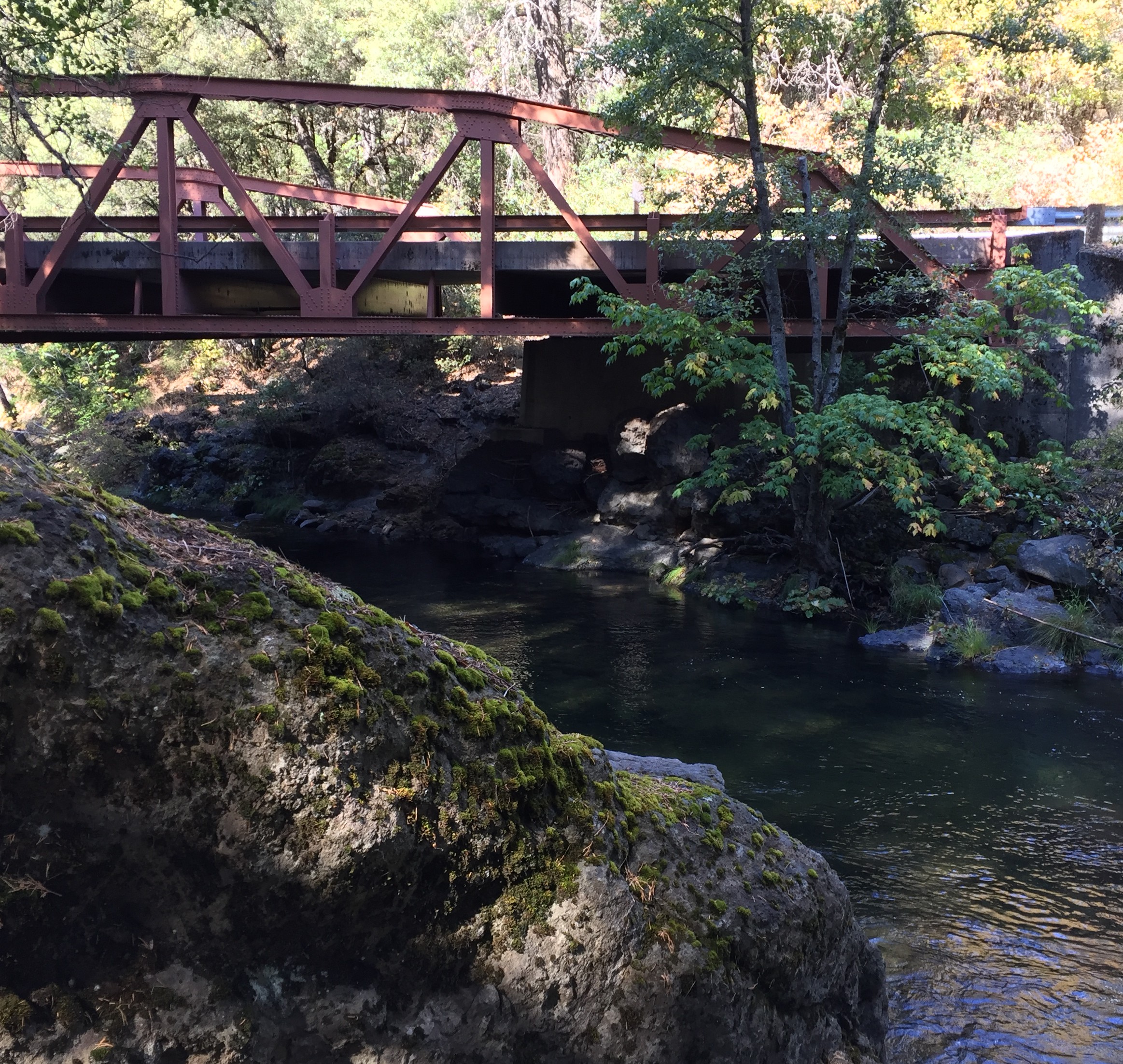
Driving directions: From the intersection of Highways 36 and 32 between Mineral and Chester, drive south on Highway 32 for 11 miles. Park in the lot on the left side just before Highway 32 crosses Deer Creek on a bridge (1.6 miles southwest of Potato Patch Campground). If you’re coming from Chico, take Highway 32 for 40 miles.
Driving time from St. Bernard Lodge: 15 minutes
This is a beautiful hike that’s accessible nearly year-round, being only occasionally covered by snow in winter. Spring is the best time to catch the wildflowers, while autumn has beautiful colors. Summer can be hot, but allows you to take a swim in the clear and cold waters. You’ll find numerous side trails down to the creek so you can sit or swim or fish.
Carefully cross Highway 32 to find the trailhead. Begin the journey in a forest of Douglas fir, ponderosa pine, incense cedar, and canyon live oak. You soon cross the first of several attractive streams that empty into Deer Creek, just before reaching a rock outcropping with a good view of the stream and the canyon.
At 0.4 mile you’ll pass a small cave and then walk a relatively level stretch near a set of small waterfalls at 1.1 miles. The main highlight of the hike arrives at 1.6 miles: Lower Deer Creek Falls. Take either of two short trails to get a full view of the 15-foot cataract and the steep volcanic canyon walls rising on both sides.
The path continues past canyon live oak and spicy-scented California laurel. It eventually drops steeply to end at Forest Road 27N08 at 2.3 miles.
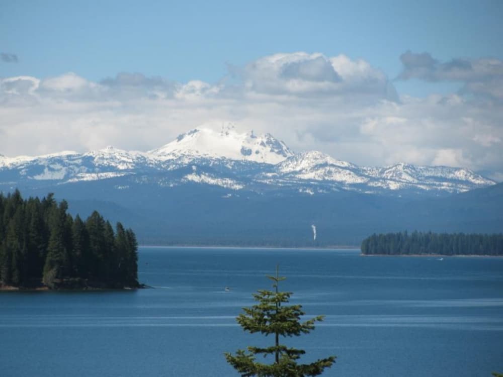
Lake Almanor Recreation Trail
Round-trip distance: up to 19 miles
High point: 4570 feet
Elevation gain: 50 feet
Season: March to November
Difficulty: 1 on a 1-5 scale
Contact: Almanor Ranger District, Lassen National Forest
Driving directions: First reach the intersection of Highways 36 and 89 west of Chester. Turn south on Highway 89 and drive 4.3 miles to where you see Humbug-Humboldt Road on the right. Instead turn left to quickly reach the first of several access points to the trail.
Driving time from St. Bernard Lodge: 15 minutes
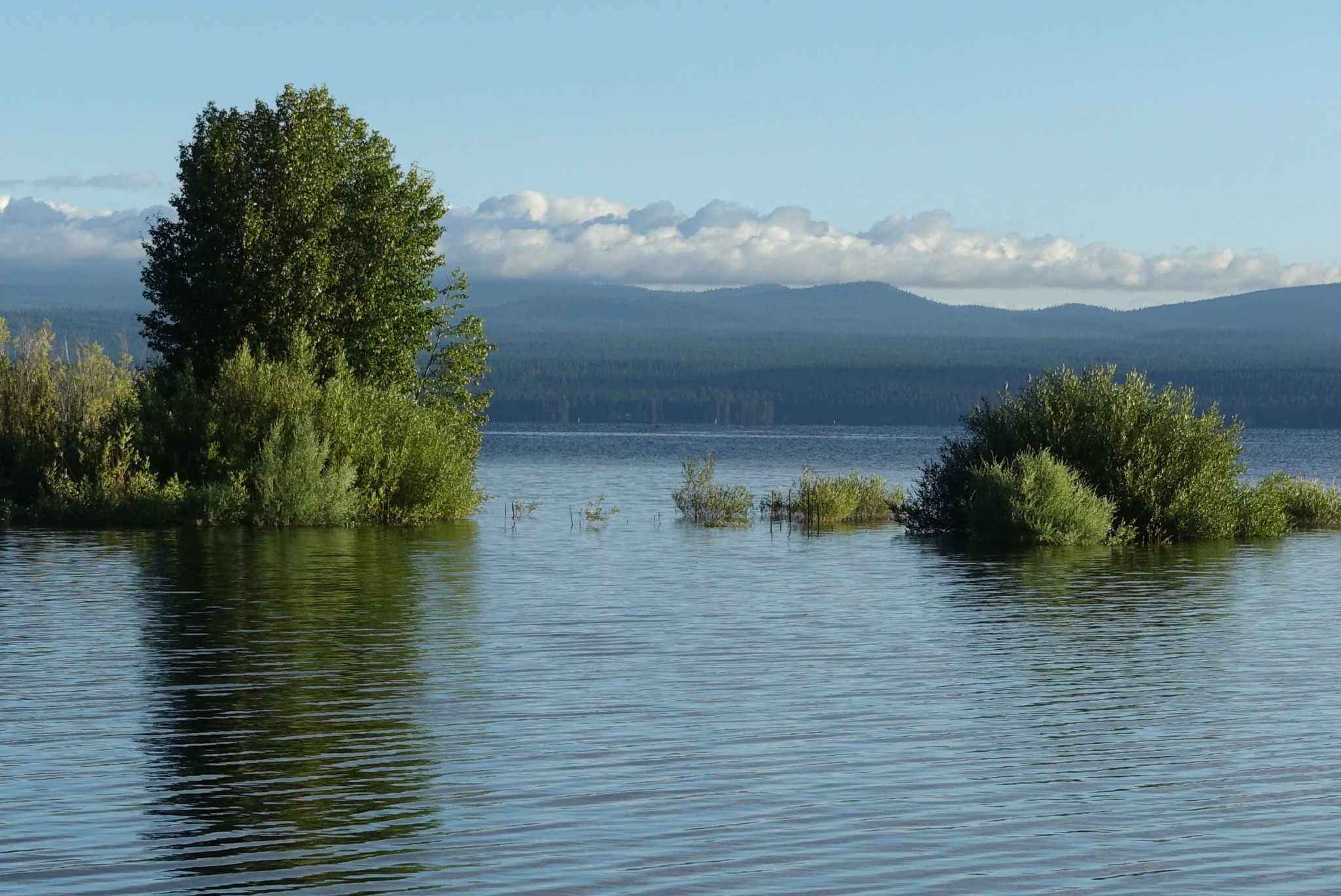
This paved and level path along and near the western shore of Lake Almanor is popular with hikers, bikers, bird watchers, and people who like to fish. There are also excellent opportunities for summer swimming.
There are several good places to access the Lake Almanor Recreation Trail that you’ll find by continuing south on Highway 89. Look for roads to the left that go to campgrounds and day-use areas; all will get you to the trail, and they typically start at or very near the lakeshore.
Wherever you begin, you’ll experience two main habitats. The first is a mixed forest of ponderosa pine, white fir, and incense cedar that often comes right down to the shore of the lake. The second is the lakeshore itself, where you’ll have open views of the water, Dyer Mountain to the northeast, Lassen Peak to the northwest, and forested ridges in all directions. The shoreline is also a great place to watch a variety of birds. You’ll see ducks and geese, of course, but you’ll also spy osprey and even bald eagles looking to snatch a fish from the lake.
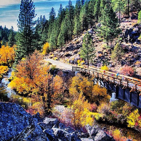
Bizz Johnson Trail
Round-trip distance: 13.4 miles ( This is one portion of the trail )
High point: 4660 feet
Elevation gain: 450 feet
Season: April to October
Difficulty: 1 on a 1-5 scale
Contact: Lassen Land and Trail Trust (530-257-3252); Eagle Lake Field Office, Bureau of Land Management
Driving directions: Reach the Devil’s Corral trailhead on the south side of Highway 36, 14 miles east of Westwood and 7 miles west of Susanville (and just a bit east of the Susan River bridge). To find the trailhead in Susanville, go south on Weatherlow Street, which turns into Richmond Road and leads to the Susanville railroad depot, which has a visitor center and informational displays. Lassen Rural Bus (www.lassentransportation.org/a/Lassen-Rural-Bus-LRB.php) runs Monday through Saturday and allows you to set up a one-way trip.
Driving time from St. Bernard Lodge: 35-50 minutes, depending on trailhead
Explore the beautiful canyon of the Susan River on this wide trail on an old railroad bed. This hike is described as beginning at Devil’s Corral, but you can also do it from the other direction by starting in Susanville at the railroad depot. Note that this is also a great ride for cyclists, so expect to share the route with them. The trail is especially beautiful in the fall when the leaves turn vibrant colors.
The Bizz Johnson Trail is named after the California congressional representative who spearheaded turning this abandoned section of the Fernley and Lassen Railroad into the broad and flat path you see before you. As you walk, you’ll pass through areas that are essentially high desert, with western juniper, antelopebrush, and sage brush, and also through areas that get more moisture and have typical forest trees like Douglas fir, white fir, and ponderosa pine. The abundance of water beside the river explains the presence of willows and cottonwoods there.
Reach the first of several bridges across the Susan River at 1.3 miles. Pass the first good swimming hole just before entering the first of two short tunnels at 1.7 miles. The path continues east to reach the outskirts of Susanville at 6.0 miles and then the Susanville railroad depot at 6.7 miles.
Note that the Bizz Johnson Trail has a total length of 25.4 miles. In addition to the segment described above, you can access the western terminus of the trail at Mason Station by taking Highway 36 to Westwood and turning left (north) onto Mooney Road (County Road A21). Go 2.9 miles and then turn right onto McCoy Road for the final 0.4 mile. The segment of the trail from here to the Devil’s Corral trailhead has the same gentle 3% grade.
This trail is great for hiking, biking, horseback riding and sometimes snowshoeing or cross-country skiing in the winter.
Lassen Rural Bus provides transportation Monday - Thursday and has buses equipped with bike racks. Special shuttles for groups of 6 or more can be arranged by calling Lassen Land and Trust trails at 530-257-3252